
Welcome to www.kit-weather.de
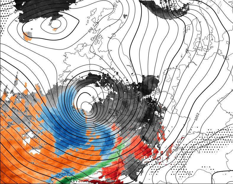
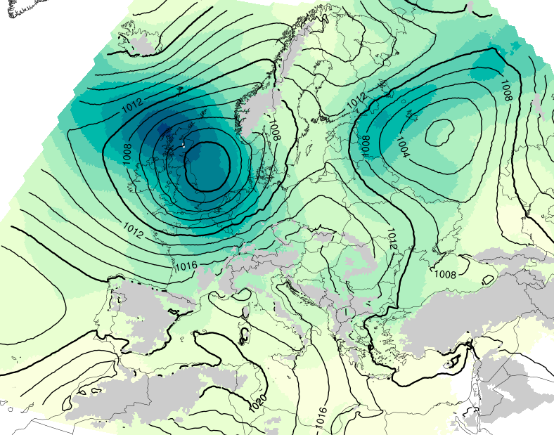
Synoptic ICON Maps
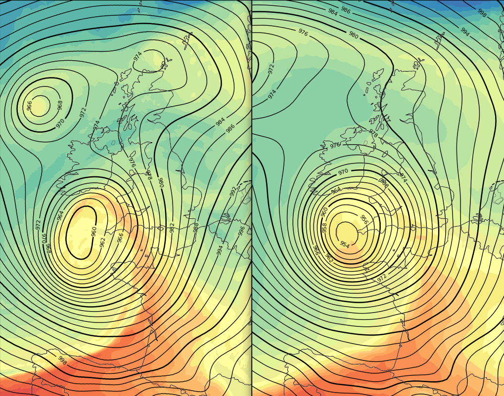
Pangu-ICON Comparison Maps
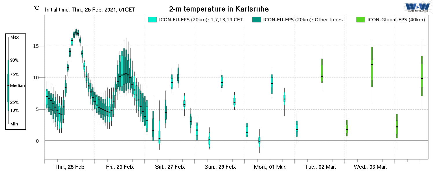
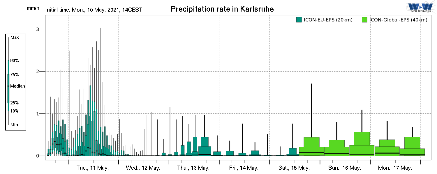
Ensemble Boxplot Meteograms
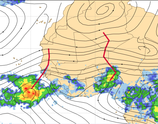
African Easterly Waves
Deterministic Maps
RAMEFI Gust Classification
in ICON-EU
WCB Probability Maps
with ECMWF-ENS
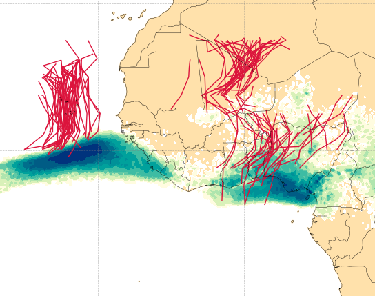
African Easterly Waves
Ensemble Maps
ICON-EU-Nest
Ensemble Spread Maps
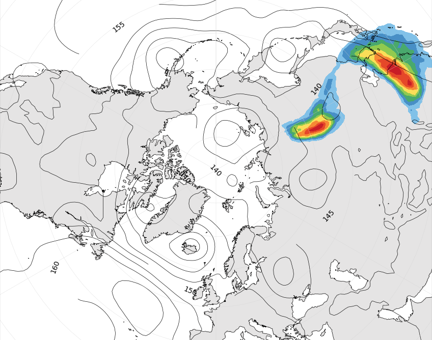
Equatorial Waves
Identification Tool
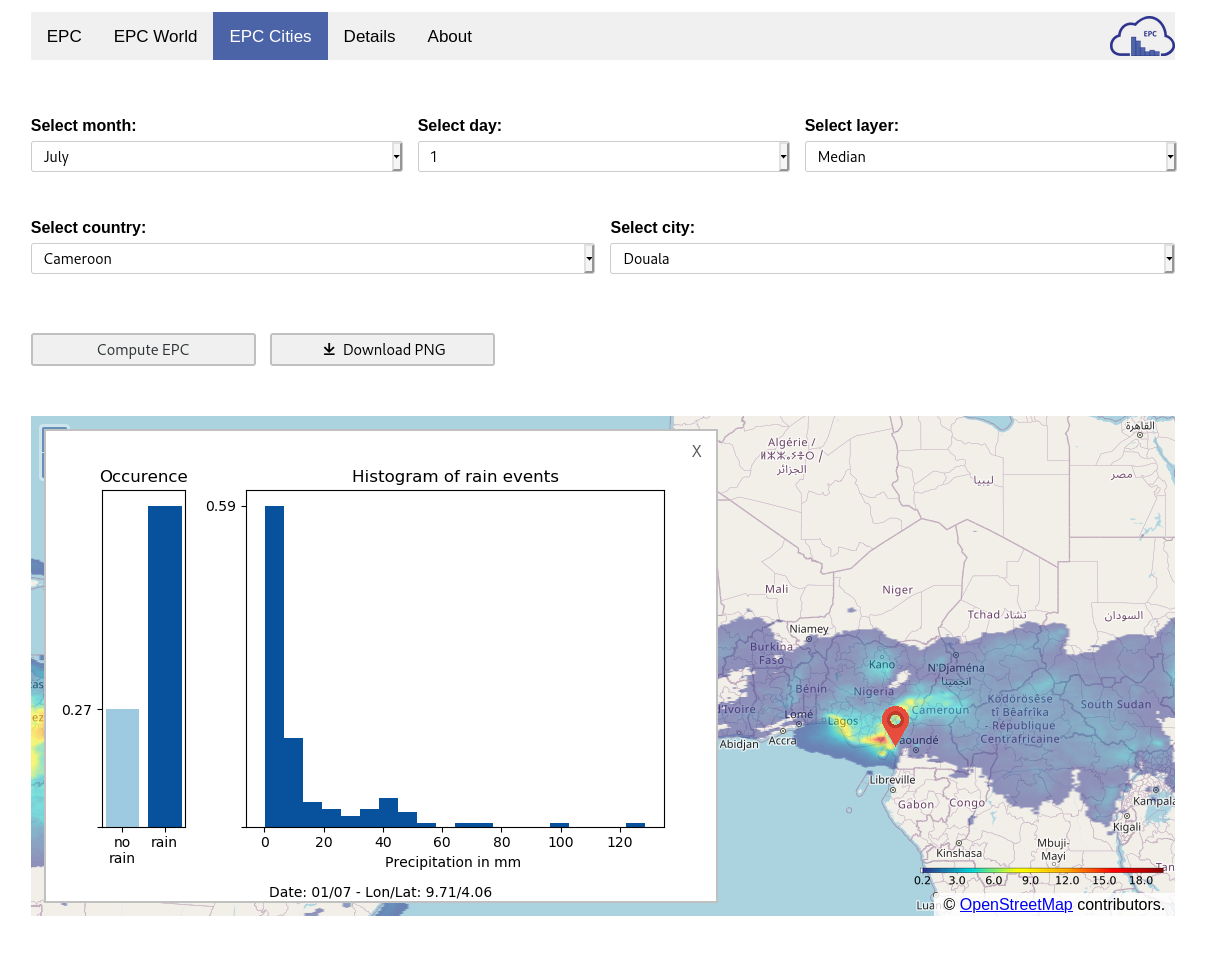
Extended Probabilistic Climatology
Here at www.kit-weather.de you can access various operational forecast maps, meteograms and generate extended probabilistic climatologies of precipitation for your locations.
The forecast data for these graphics comes from the Opendata Service of Germany's National Meteorological Service, the Deutscher Wetterdienst (DWD) who runs the Global ICON and ICON-EPS models. Data from the ECMWF Open data catalogue and the NOAA GFS Open data S3 bucket is also being used. Here at KIT IMKTRO the latest forecast data is being downloaded and processed automatically several times a day.
The extended probabilistic climatology for precipitation uses 18 years of the IMERG Final dataset to generate histograms for user-specific locations between 40°N und 40°S.
The work for this page was funded under the Waves to Weather (W2W) Project.